Loading...
Done
In this Friday, March 28, 2014 photo, singers of the Moranbong Band, Jong Su Hyang, foreground, and  Pak Mi Kyong, left perform on their stage in Pyongyang, North Korea. Step aside, Sea of Blood Opera. North Korean leader Kim Jong Un's favorite guitar-slinging, miniskirt-sporting girl group, the Moranbong Band, is back. And these ladies know how to shimmy. (Photo by Jon Chol Jin/AP Photo)

In this Friday, March 28, 2014 photo, singers of the Moranbong Band, Jong Su Hyang, foreground, and Pak Mi Kyong, left perform on their stage in Pyongyang, North Korea. Step aside, Sea of Blood Opera. North Korean leader Kim Jong Un's favorite guitar-slinging, miniskirt-sporting girl group, the Moranbong Band, is back. And these ladies know how to shimmy. (Photo by Jon Chol Jin/AP Photo)
Details
27 Apr 2014 07:07:00
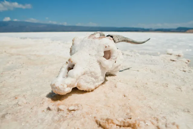
Lake Assal Crater Lake In The Central Djibouti

Lake Assal is a crater lake in central-western Djibouti. It is located at the western end of Gulf of Tadjoura in the Tadjoura Region, touching Dikhil Region, at the top of the Great Rift Valley, some 120 km (75 mi) west of Djibouti city. Lake Assal is a saline lake which lies 155 m (509 ft) below sea level in the Afar Triangle, making it the lowest point on land in Africa and the third-lowest land depression on Earth after the Dead Sea and Sea of Galilee.
Details
15 Jul 2015 10:19:00
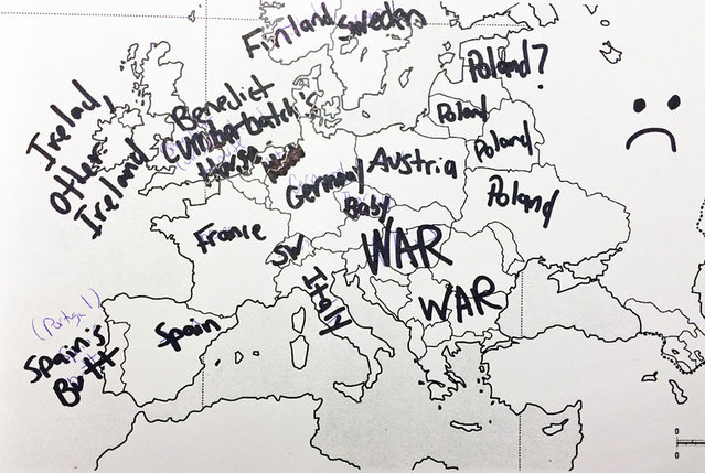
Americans Try To Place European Countries On A Map Part 1

How sure are you of your geographical knowledge? Buzzfeed recently put Americans’ geographical knowledge to the test with a survey in which participants had to write in countries’ names on a blank European political map. Unfortunately, they didn’t fare too well, but some of their responses are hilarious (or hilariously mis-informed). But don’t be so quick to judge Americans – when Buzzfeed posted a similar survey testing Brits’ knowledge of the 50 United States, they also came up short. On the one hand, knowing a country’s states is different from knowing independent countries, but on the other, some U.S. states are larger than some European nations, and some U.S. states have larger economies than some European nations.
Details
02 Dec 2013 11:24:00
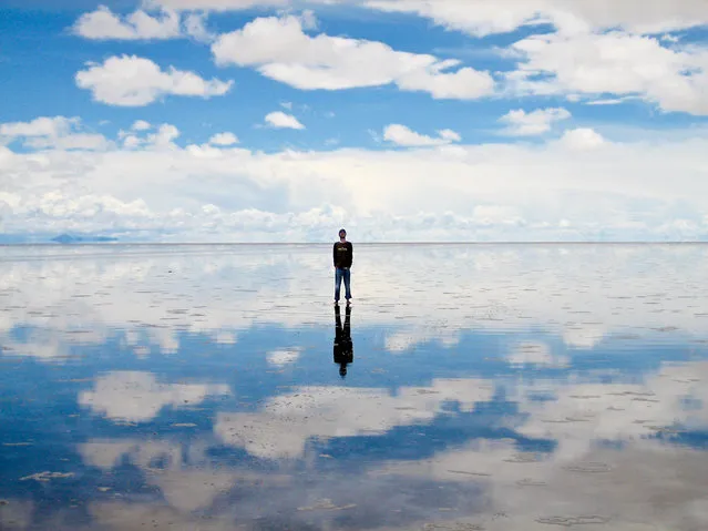
Salar de Uyuni

Salar de Uyuni (or Salar de Tunupa) is the world's largest salt flat at 10,582 square kilometers (4,086 sq mi). It is located in the Potosí and Oruro departments in southwest Bolivia, near the crest of the Andes, and is elevated 3,656 meters (11,995 ft) above mean sea level. The Salar was formed as a result of transformations between several prehistoric lakes. It is covered by a few meters of salt crust, which has an extraordinary flatness with the average altitude variations within one meter over the entire area of the Salar.
Details
04 Aug 2012 08:42:00
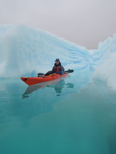
Chasing Ice in Greenland

The Greenland ice sheet is a vast body of ice covering 660,235 sq miles, roughly 80% of the surface of Greenland. It is the second largest ice body in the world, after the Antarctic Ice Sheet. Some scientists predict that climate change may be near a "tipping point" where the entire ice sheet will melt in about 2000 years. If the entire 2,850,000 cubic kilometres (683,751 cu mi) of ice were to melt, it would lead to a global sea level rise of 7.2 m (23.6 ft).
Details
30 Apr 2014 13:15:00
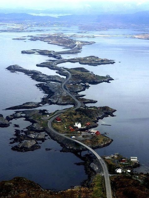
The Atlantic Road, Norway

The Atlantic Ocean Road or the Atlantic Road (Norwegian: Atlanterhavsveien) is a 8.3-kilometer (5.2 mi) long section of County Road 64 that runs through an archipelago in Eide and Averøy in Møre og Romsdal, Norway. It passes by Hustadvika, an unsheltered part of the Norwegian Sea, connecting the island of Averøy with the mainland and Romsdalshalvoya peninsula. It runs between the villages of Karvag on Averoy and Vevang in Eida. It is built on several small islands and skerries, which are connected by several causeways, viaducts and eight bridges – the most prominent being Storseisundet Bridge.
Details
18 Jan 2014 11:42:00
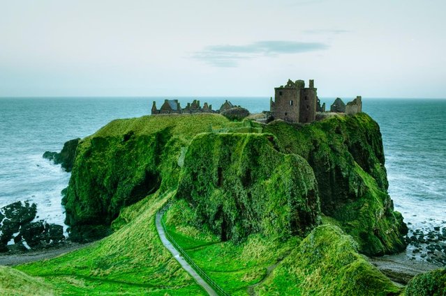
Dunnottar Castle In Scottish

Dunnottar Castleis a ruined medieval fortress located upon a rocky headland on the north-east coast of Scotland, about 3 kilometres (1.9 mi) south of Stonehaven. The surviving buildings are largely of the 15th and 16th centuries, but the site is believed to have been fortified in the Early Middle Ages. Dunnottar has played a prominent role in the history of Scotland through to the 18th-century Jacobite risings because of its strategic location and the strength of its situation. Dunnottar is best known as the place where the Honours of Scotland, the Scottish crown jewels, were hidden from Oliver Cromwell's invading army in the 17th century. The property of the Keiths from the 14th century, and the seat of the Earl Marischal, Dunnottar declined after the last Earl forfeited his titles by taking part in the Jacobite rebellion of 1715. The castle was restored in the 20th century and is now open to the public.
Details
13 Jan 2014 11:31:00
Women take part in Belarus Cup in bodybuilding and fitness in Minsk, October 24, 2015. (Photo by Vasily Fedosenko/Reuters)

Women take part in Belarus Cup in bodybuilding and fitness in Minsk, October 24, 2015. (Photo by Vasily Fedosenko/Reuters)
Details
27 Oct 2015 08:03:00