Loading...
Done
Wonderful Food Maps By Henry Hargreaves And Caitlin Levin

Photographer Henry Hargreaves and artist Caitlin Levin have been working together for about decade. Their shared love for “food, photography, travel, and art” has found an outlet in a series of maps that they have illustrated with food.
Details
14 Aug 2014 10:21:00
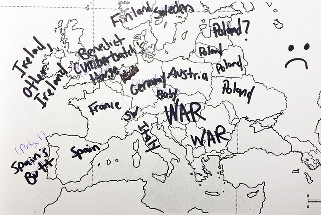
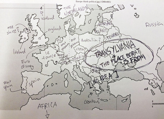
Americans Try To Place European Countries On A Map Part 2

How sure are you of your geographical knowledge? Buzzfeed recently put Americans’ geographical knowledge to the test with a survey in which participants had to write in countries’ names on a blank European political map. Unfortunately, they didn’t fare too well, but some of their responses are hilarious (or hilariously mis-informed). But don’t be so quick to judge Americans – when Buzzfeed posted a similar survey testing Brits’ knowledge of the 50 United States, they also came up short. On the one hand, knowing a country’s states is different from knowing independent countries, but on the other, some U.S. states are larger than some European nations, and some U.S. states have larger economies than some European nations.
Details
03 Dec 2013 08:45:00
Americans Try To Place European Countries On A Map Part 1

How sure are you of your geographical knowledge? Buzzfeed recently put Americans’ geographical knowledge to the test with a survey in which participants had to write in countries’ names on a blank European political map. Unfortunately, they didn’t fare too well, but some of their responses are hilarious (or hilariously mis-informed). But don’t be so quick to judge Americans – when Buzzfeed posted a similar survey testing Brits’ knowledge of the 50 United States, they also came up short. On the one hand, knowing a country’s states is different from knowing independent countries, but on the other, some U.S. states are larger than some European nations, and some U.S. states have larger economies than some European nations.
Details
02 Dec 2013 11:24:00


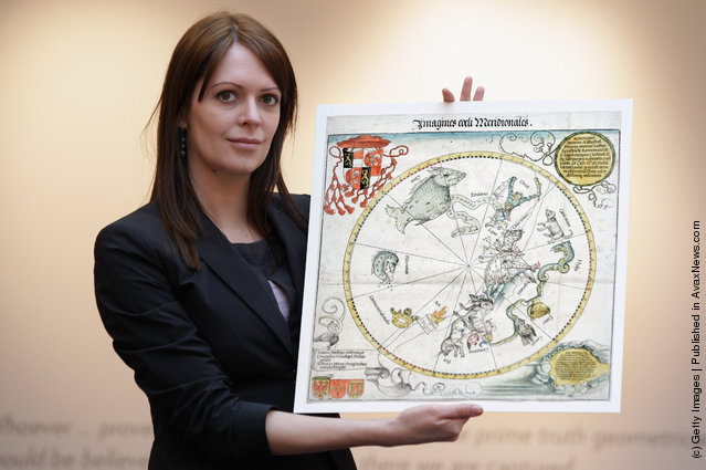
Head of European Prints, Severine Nackers holds a celestial Map of the Southern Sky by Albrecht Durer, at Sotheby's Auction House on March 25, 2011 in London, England. The two woodcut maps depicting the Northern and Southern skies circa 1515, are the earliest printed star charts of their kind ever published in Europe, and are expected to fetch between Ј120,000-180,000 GBP when they go on sale at the “London sale of Old Master, Modern and Contemporary prints” at Sotheby's Auction house on March 30, 2011. (Photo by Dan Kitwood/Getty Images)
Details
25 Mar 2011 14:57:00