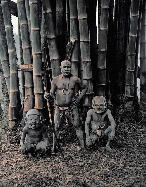
“Asaro from the Eastern Highlands”. The mudmen could not cover their faces with mud because the people of Papua New Guinea thought that the mud from the Asaro river was poisonous. So instead of covering their faces with this alleged poison, they made masks from pebbles that they heated and water from the waterfall, with unusual designs such as long or very short ears either going down to the chin or sticking up at the top, long joined eyebrows attached to the top of the ears, horns and sideways mouths. (Photo and caption by Jimmy Nelson)
20 Oct 2013 08:54:00,post received
0 comments