Loading...
Done
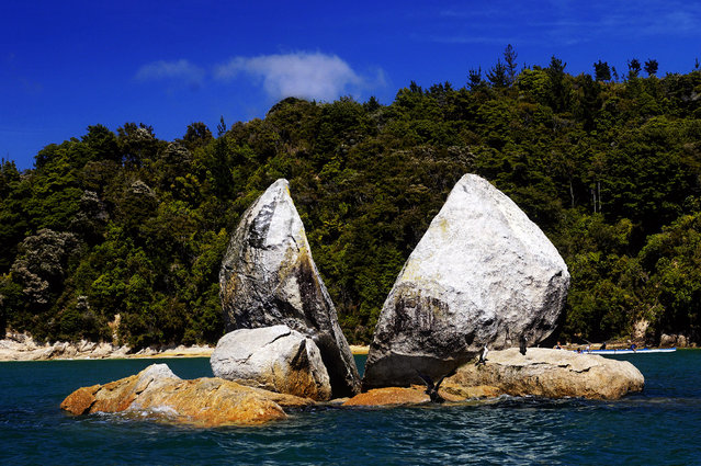
Split Apple Rock

Split Apple Rock is a geological rock formation in The Tasman Bay off the northern coast of the South Island of New Zealand. Made of granite, it is in the shape of an apple which has been cut in half. It is a popular tourist attraction in the waters of the Tasman Sea approximately 50 metres off the coast between Kaiteriteri and Marahau. The rock sits in shallow water at low tide and is accessible by wading. It is also a point of interest for the many tourist boats and pleasure craft which operate along the shores of the Abel Tasman National Park. The cleft to produce two sides of the 'apple' was a natural occurrence. It is unknown when this happened and therefore the cleaving of the rock has attracted mythological explanations.
Details
19 Oct 2013 10:58:00
White Lion Cubs

“The white lion is not a distinct subspecies, but a special morph with a genetic condition, leucism, that causes paler colouration akin to that of the white tiger; the condition is similar to melanism, which causes black panthers”. – Wikipedia

Photo: One of two rare white lion cubs from Mogo Zoo on New South Wales South Coast is seen at a photo call at Lavender Green, Luna Park on November 23, 2006 in Sydney, Australia. (Photo by Matt King/Getty Images)
Details
26 Sep 2011 12:01:00
Women comfort each other as they mourn over the death of a family member who was killed in a bomb blast, at a local hospital in Lahore, Pakistan, Sunday, March, 27, 2016. (Photo by K.M. Chuadary/AP Photo)

Women comfort each other as they mourn over the death of a family member who was killed in a bomb blast, at a local hospital in Lahore, Pakistan, Sunday, March, 27, 2016. A bomb blast in a park in the eastern Pakistani city of Lahore has killed tens of people and wounded scores, a health official said. (Photo by K.M. Chuadary/AP Photo)
Details
28 Mar 2016 10:12:00
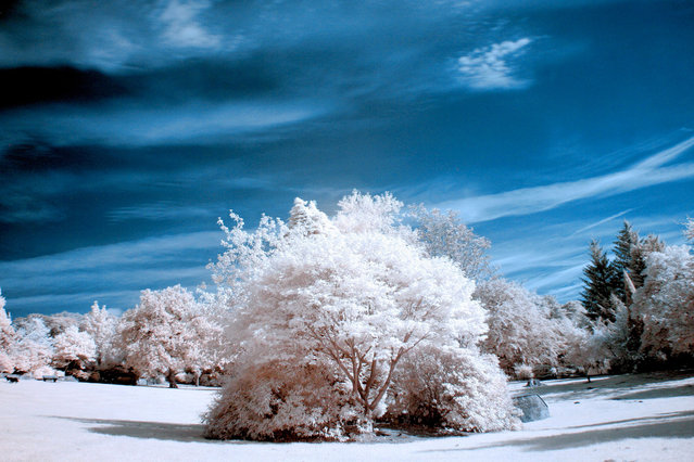
Colzium House Park, in Kilsyth pictured in infra-red. These are the stunning images of what looks like a picturesque winter wonderland – but actually shot in the middle of summer. Amateur photographer Catherine Perkinton, 45, has spent the summer travelling around the country to create the fabulous images by utilising infra-red. (Photo by Catherine Perkinton/SWNS/ABACAPress)

These are the stunning images of what looks like a picturesque winter wonderland – but actually shot in the middle of summer. Amateur photographer Catherine Perkinton, 45, has spent the summer travelling around the country to create the fabulous images by utilising infra-red. (Photo by Catherine Perkinton/SWNS/ABACAPress)
Details
24 Sep 2014 11:46:00
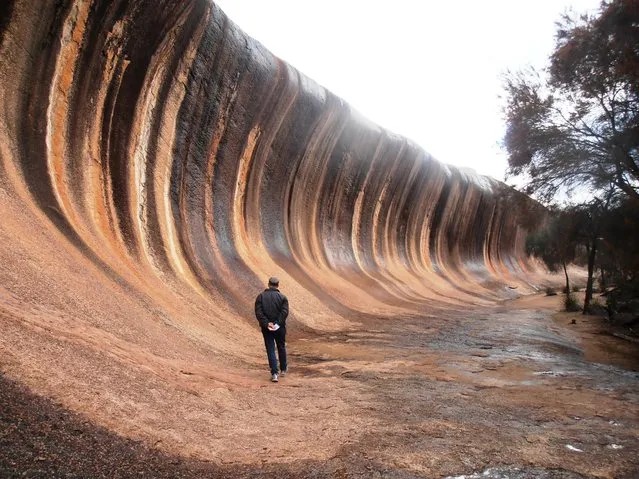
Wave Rock, Arizona

Wave Rock is a natural rock formation that is shaped like a tall breaking ocean wave. The "wave" is about 14 m (46 ft) high and around 110 m (360 ft) long. It forms the north side of a solitary hill, which is known as “Hyden Rock”. This hill, which is a granite inselberg, lies about 3 km (2 mi) east of the small town of Hyden and 296 km (184 mi) east-southeast of Perth, Western Australia. Wave Rock and Hyden Rock are part of a 160 ha (395-acre) nature reserve, Hyden Wildlife Park.
Details
12 Aug 2014 10:21:00
A schoolgirl walks on an under-construction railway track at Navapura, on the outskirts of Ahmedabad, November 29, 2019. (Photo by Amit Dave/Reuters)

A schoolgirl walks on an under-construction railway track at Navapura, on the outskirts of Ahmedabad, November 29, 2019. (Photo by Amit Dave/Reuters)
Details
14 Dec 2019 00:01:00
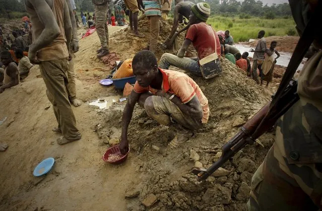
A gold prospector sits and eats close to a soldier at a gold mine near the village of Gamina, in western Ivory Coast, March 18, 2015. (Photo by Luc Gnago/Reuters)

Nestled among the cocoa plantations of western Ivory Coast is a gold mine that does not feature on any official maps. It is not run by an industrial mining company, nor does it pay taxes to the central government. The unlicensed mine is a key part of a lucrative business empire headed by the deputy commander of the West African nation's elite Republican Guard, United Nations investigators allege. Here: A gold prospector sits and eats close to a soldier at a gold mine near the village of Gamina, in western Ivory Coast, March 18, 2015. (Photo by Luc Gnago/Reuters)
Details
08 May 2015 13:54:00
This combination of August 30, 2005 and July 29, 2015 aerial photos shows downtown New Orleans and the Superdome flooded by Hurricane Katrina and the same area a decade later. Katrina's powerful winds and driving rain bore down on Louisiana on August 29, 2005. (Photo by David J. Phillip/Gerald Herbert/AP Photo)

This combination of August 30, 2005 and July 29, 2015 aerial photos shows downtown New Orleans and the Superdome flooded by Hurricane Katrina and the same area a decade later. Katrina's powerful winds and driving rain bore down on Louisiana on August 29, 2005. The storm caused major damage to the Gulf Coast from Texas to central Florida while powering a storm surge that breached the system of levees that were built to protect New Orleans from flooding. (Photo by David J. Phillip/Gerald Herbert/AP Photo)
Details
29 Aug 2015 11:22:00