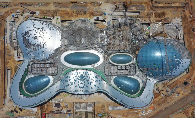
Aerial photo taken on April 10, 2022 shows the construction site of Haikou duty-free shopping complex in Haikou, south China's Hainan Province. With a total construction area of about 926,000 square meters, the Haikou duty-free shopping complex project is expected to be officially put into use this year. (Photo by Xinhua News Agency/Rex Features/Shutterstock)
27 May 2022 04:48:00,post received
0 comments