Loading...
Done
Abandon Village: Doel, Belgium

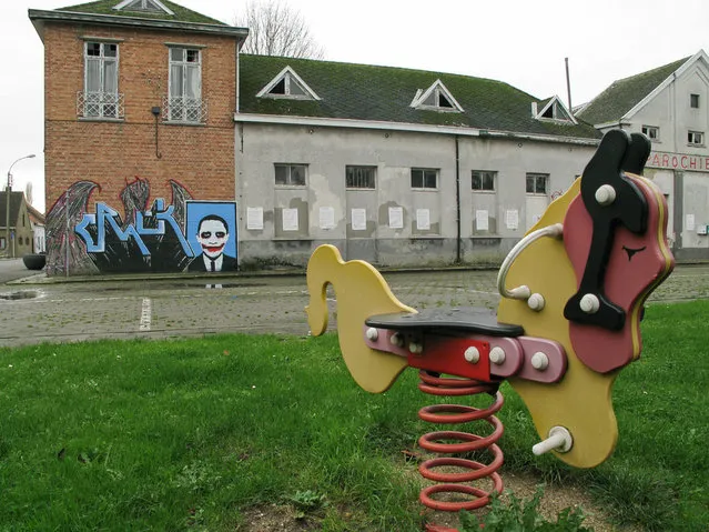
Doel is a 700 year old village on the river Scheldt in Belgium. Near to the local nuclear power plant, with its two giant cooling towers, it became the target for demolition not once but twice in order to make way for the ever expanding harbor. The successful protest groups of the seventies could not compete in the 90's and as residents began to leave, the government refused to rent out the properties again and instead let them fall into disrepair. On the 23rd of March 2007, the government decided that the village would be demolished by 2009 and in June 2008, residents received a letter informing them that they were to vacate their homes by the 1st of September 2009.
Details
20 Mar 2013 11:33:00
 Iguazu Falls

Iguazu Falls are waterfalls of the Iguazu River on the border of the Brazilian state of Paraná and the Argentinian province of Misiones. The falls divide the river into the upper and lower Iguazu. The Iguazu River rises near the city of Curitiba. It flows through Brazil for most of its course. Below its confluence with the San Antonio River, the Iguazu River forms the boundary between Argentina and Brazil.
Details
15 Jul 2013 11:54:00
Oresund Bridge

The Öresund or Øresund Bridge is a double-track railway and dual carriageway bridge-tunnel across the Øresund strait between Scania (southernmost Sweden) and Denmark. The bridge runs nearly 8 km (5 miles) from the Swedish coast to the artificial island of Peberholm, which lies in the middle of the strait. The remainder of the link is by a 4 km (2.5 mile) tunnel from Peberholm to the Danish island of Amager. The Øresund Bridge is the longest combined road and rail bridge in Europe, and connects two major metropolitan areas: Copenhagen, the Danish capital city, and the major Swedish city of Malmö. It connects the road and rail networks of Scandinavia with those of Central and Western Europe.
Details
10 Sep 2013 11:23:00
Moraine Lake Canada

Moraine Lake is a glacially-fed lake in Banff National Park, 14 kilometres (8.7 mi) outside the Village of Lake Louise, Alberta, Canada. It is situated in the Valley of the Ten Peaks, at an elevation of approximately 6,183 feet (1,885 m). The lake has a surface area of .5 square kilometres (0.19 sq mi). The lake, being glacially fed, does not reach its crest until mid to late June. When it is full, it reflects a distinct shade of blue. The colour is due to the refraction of light off the rock flour deposited in the lake on a continual basis.
Details
15 Oct 2013 11:56:00
Buddhist Monastery Key Gompa

Key Gompa (also spelled Ki, Kye or Kee) is a Tibetan Buddhist monastery located on top of a hill at an altitude of 4,166 metres (13,668 ft) above sea level, close to the Spiti River, in the Spiti Valley of Himachal Pradesh, Lahaul and Spiti district, India. It is the biggest monastery of Spiti Valley and a religious training centre for Lamas. It reportedly had 100 monks in 1855.
Details
05 Dec 2013 10:48:00
Broadway Tower In English

Broadway Tower is a folly located on Broadway Hill, near the village of Broadway, in the English county of Worcestershire, at the second highest point of the Cotswolds after Cleeve Hill. Broadway Tower's base is 1,024 feet (312 metres) above sea level. The tower itself stands 55 feet (17 metres) high. The “Saxon” tower was designed by James Wyatt in 1794 in the form of a castle, and built for Lady Coventry in 1799. The tower was built on a “beacon” hill, where beacons were lit on special occasions. Lady Coventry wondered if a beacon on this hill could be seen from her house in Worcester – approximately 22 miles (35 km) away – and sponsored the construction of the folly to find out. The beacon could be seen clearly.
Details
19 Dec 2013 10:06:00
Dive The Deadly Jacob’s Well In Texas

Jacob's Well is a perennial karstic spring in the Texas Hill Country flowing from the bed of Cypress Creek, located northwest of Wimberley, Texas. The twelve foot (four meter) diameter mouth of the spring serves as a popular swimming spot for the local land owners whose properties adjoin Cypress Creek. From the opening in the creek bed, Jacob's Well cave descends vertically for about thirty feet (ten meters), then continues downward at an angle through a series of silted chambers separated by narrow restrictions, finally reaching a depth of one hundred and twenty feet (forty meters). Until the modern era, the Trinity Aquifer-fed natural artesian spring gushed water from the mouth of the cave, with a measured flow in 1924 of one hundred and seventy gallons per second (six hundred and forty liters per second) discharging six feet (two meters) into the air. The spring is the greatest source of water recharging the Edwards Aquifer.
Details
03 Jan 2014 08:20:00
The Atlantic Road, Norway

The Atlantic Ocean Road or the Atlantic Road (Norwegian: Atlanterhavsveien) is a 8.3-kilometer (5.2 mi) long section of County Road 64 that runs through an archipelago in Eide and Averøy in Møre og Romsdal, Norway. It passes by Hustadvika, an unsheltered part of the Norwegian Sea, connecting the island of Averøy with the mainland and Romsdalshalvoya peninsula. It runs between the villages of Karvag on Averoy and Vevang in Eida. It is built on several small islands and skerries, which are connected by several causeways, viaducts and eight bridges – the most prominent being Storseisundet Bridge.
Details
18 Jan 2014 11:42:00