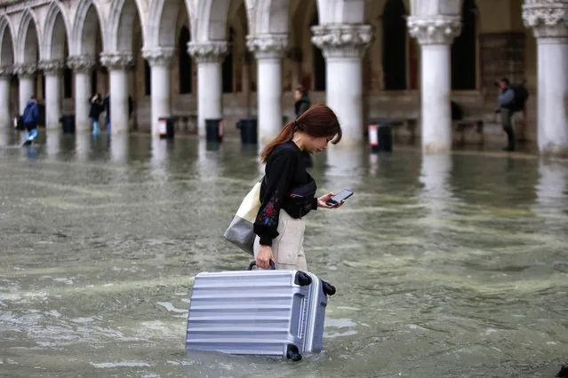
A tourist carries her luggage in a flooded St. Mark's Square, in Venice, Wednesday, November 13, 2019. The high-water mark hit 187 centimeters (74 inches) late Tuesday, Nov. 12, 2019, meaning more than 85% of the city was flooded. The highest level ever recorded was 194 centimeters (76 inches) during infamous flooding in 1966. (Photo by Luca Bruno/AP Photo)
05 Feb 2020 00:01:00,post received
0 comments