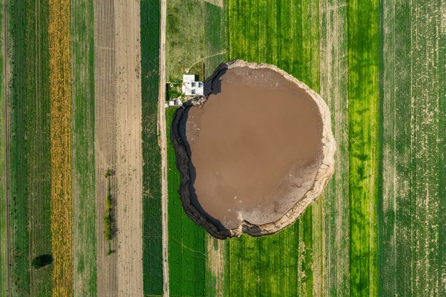
Aerial view of a giant sinkhole on June 09, 2021 in Santa María Zacatepec, Mexico. The giant sinkhole is located 20 kilometers northwest from the capital city Puebla, the hole now measures 110 meters across its widest point, covering around 11,000 square meters and damaging a house built near the place where it appeared. Farmers of the surroundings have been affected since they are not allowed to enter their fields due to the warning perimeter set up by the authorities. (Photo by Hector Vivas/Getty Images)
10 Aug 2021 09:48:00,post received
0 comments