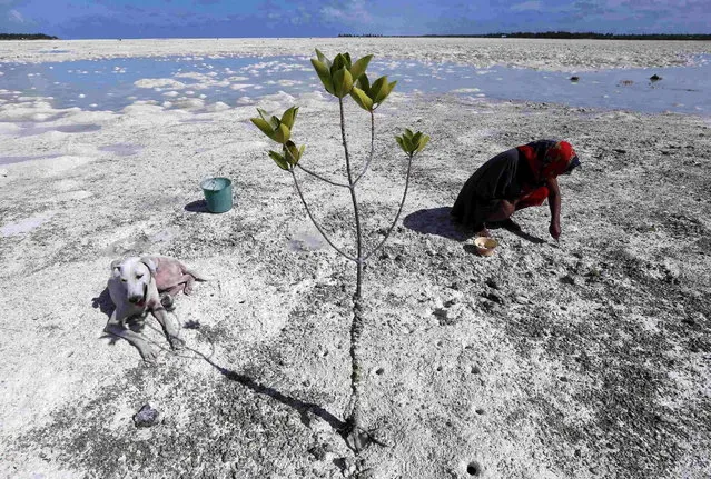
A dog sits in the shade of a mangrove tree as a woman uses a fork to dig for shellfish on the reef-mud flats of a lagoon located at South Tarawa in the central Pacific island nation of Kiribati May 23, 2013. Kiribati consists of a chain of 33 atolls and islands that stand just metres above sea level, spread over a huge expanse of otherwise empty ocean. With surrounding sea levels rising, Kiribati President Anote Tong has predicted his country will likely become uninhabitable in 30-60 years because of inundation and contamination of its freshwater supplies. (Photo by David Gray/Reuters)
13 Jun 2013 09:23:00,post received
0 comments