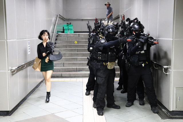
A woman walks past as South Korean soldiers participate in an anti-chemical and anti-terror exercise as part of the 2023 Ulchi Freedom Shield (UFS) at subway station on August 22, 2023 in Seoul, South Korea. The 11-day exercise, which features drills including the handling of chemical and biological attacks, is a regular joint exercise between U.S. and South Korean troops. (Photo by Chung Sung-Jun/Getty Images)
26 Aug 2023 02:53:00,post received
0 comments