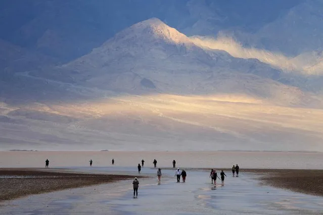
Tourists enjoy the rare opportunity to walk in water as they visit Badwater Basin, the normally driest place in the US, in Death Valley National Park, Inyo County, California on February 18, 2024. Badwater Basin, an endorheic basin in Death Valley National Park, was flooded by Hurricane Hilary in August 2023 and recent rains in California. It is the lowest point in North America, at 282 feet (86 meters) below sea level. (Photo by David Swanson/AFP Photo)
27 Feb 2024 07:33:00,post received
0 comments