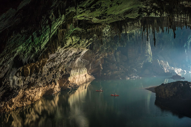
Floating on clear deep water and reflections near the cave entrance. Visitors can either bring their own kayaks or rent boats from the local community to paddle deep inside the cave and marvel at its wonders on March 2015 at Tham Khoun Ex, Laos. Tham Khoun Xe, commonly known as the Xe Bang Fai River Cave, in Laos, has over 15km of passages filled with awe-inspiring views and wide expanses of water. Photographer, John Spies, 59, captured scenes from the entrances of the huge underground river passages, intricate cave formations and views from a passage high above the water. The cave is formed by the Xe Bang Fai river, a major tributary of the Mekong and in the dry season can be traversed using inflatable kayaks. (Photo by John Spies/Barcroft Media/ABACAPress)