Miranda Kerr arrives for the 9th Annual G'Day USA Los Angeles Black Tie gala on January 14, 2012 in Hollywood, California. (Photo by Toby Canham/Getty Images)
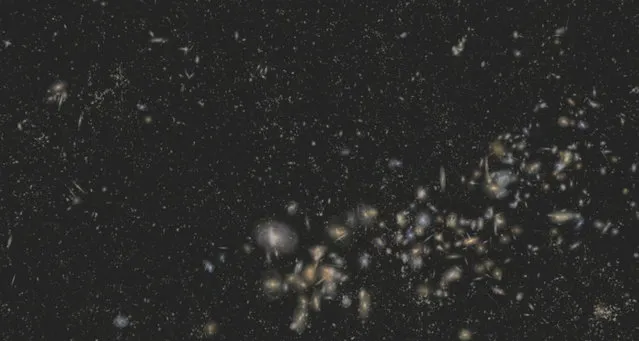
“The Sloan Digital Sky Survey III (SDSS-III) has released the largest-ever three-dimensional map of massive galaxies and distant black holes, which will help astronomers explain the mysterious “dark matter” and “dark energy” that scientists know makes up 96 percent of the Universe”. – SDSS-III
Models Miranda Kerr, Candice Swanepoel, Adriana Lima and Erin Heatherton attend The Reveal of the What Is s*xy? List celebrated by Victoria's Secret Bombshells at The Beverly on May 12, 2011 in Los Angeles, California. (Photo by Charley Gallay/Getty Images for Victoria's Secret)
Ecuadorean spontaneous bullfighters participate in a popular bull festival called Las Canteras del Antisana at Pinantura village on the base of the Antisana volcano in Quito, November 28, 2015. (Photo by Guillermo Granja/Reuters)
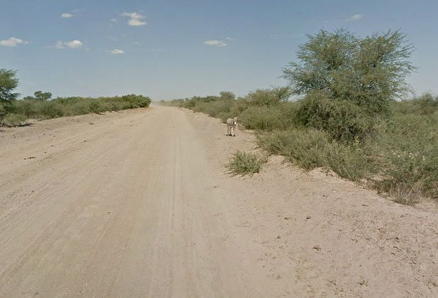
When Google Maps was capturing images of a Street View in Botswana, it appeared that this donkey had been hit by a car. However, a representative from Google Maps has confirmed that the donkey was merely enjoying a roll in the dirt and is alive and well.
A woman wears VR glasses while the projection mapping is cast on table and walls during its media preview at “TREE BY NAKED, yoyogi park” restaurant in Tokyo, Japan on July 19, 2018. This restaurant incorporates virtual reality, projection mapping, and music to enhance diners' enjoyment of their food. (Photo by Kim Kyung-Hoon/Reuters)
Jensen a two-year-old False Map turtle, from the Mississippi River, gets used to his new home at Blackpool Sea Life Centre on February 13, 2012 in Blackpool, England. (Photo by Christopher Furlong/Getty Images)
From Britain to China to Mali, new maps showing travel times to the nearest urban centre reveal huge differences between countries. Using Open Street Map and Google, a University of Oxford team have created a visual breakdown that suggests major inequalities when it comes to commuting. Here: China. The dataset used for China was unique as it relied solely on Open Street Map, due to restrictions on accessing Google data. The population is densely concentrated in the east and accessibility is increased, whereas rural provinces in the west remain remote. (Photo by Daniel Weiss/Jennifer Rozier/Malaria Atlas Project/University of Oxford)