Loading...
Done
New Illustrations In The Sky Between Buildings By Thomas Lamadieu

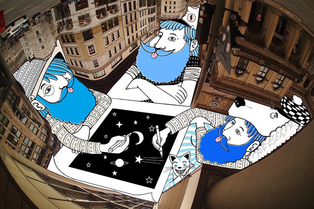
French artist Thomas Lamadieu, also know as Roots Art, must really love looking at the sky. Every time he looks up, Thomas sees a potential canvas where the building rooftops frame the sky. He photographs it and uses the odd sky shapes to create whimsical line drawings. “My artistic aim is to show a different perception of urban architecture and the everyday environment around us, what we can construct with a boundless imagination,” says Thomas. (Photo by Thomas Lamadieu)


See Also:Whimsical Sky Art by Thomas Lamadieu
Details
26 Apr 2014 11:43:00
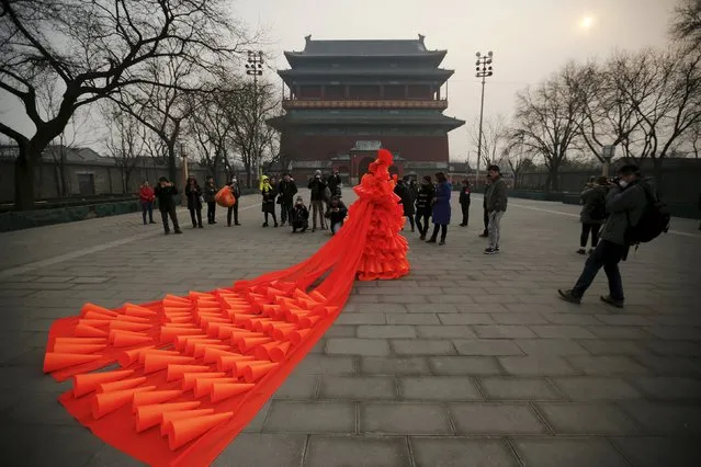
Chinese artist Kong Ning walks in her costume made of hundreds of orange plastic blowing horns during her art performance raising awareness of the hazardous smog in front of the Drum tower in a historical part of Beijing on a very polluted day December 7, 2015. (Photo by Damir Sagolj/Reuters)

Chinese artist Kong Ning walks in her costume made of hundreds of orange plastic blowing horns during her art performance raising awareness of the hazardous smog in front of the Drum tower in a historical part of Beijing on a very polluted day December 7, 2015. Kong, whose works include themes related to China's air pollution problem, named her new performance “The Orange Horns Bride Marries the Blue Sky” and presented it dressed in orange, the colour of the second highest pollution alert level issued again in Beijing as hazardous smog blankets the capital. (Photo by Damir Sagolj/Reuters)
Details
09 Dec 2015 08:05:00


Anne Hathaway arrives for the premiere of Twentieth Century Fox & Blue Sky Studios' “RIO” on April 10, 2011 in Hollywood, California. (Photo by John Sciulli/Getty Images)
Details
16 Apr 2011 11:47:00
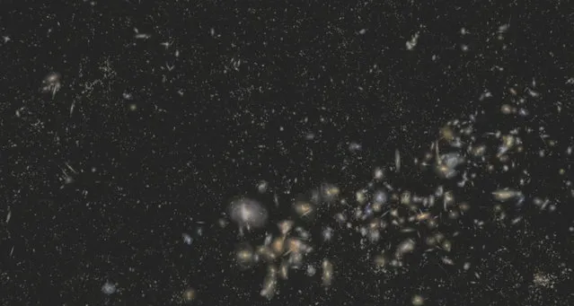
New 3-D Map of Massive Galaxies and Distant Black Holes Offers Clues to Dark Matter and Dark Energy

“The Sloan Digital Sky Survey III (SDSS-III) has released the largest-ever three-dimensional map of massive galaxies and distant black holes, which will help astronomers explain the mysterious “dark matter” and “dark energy” that scientists know makes up 96 percent of the Universe”. – SDSS-III
Details
10 Aug 2012 09:01:00
A woman wears VR glasses while the projection mapping is cast on table and walls during its media preview at “TREE BY NAKED, yoyogi park” restaurant in Tokyo, Japan on July 19, 2018. (Photo by Kim Kyung-Hoon/Reuters)

A woman wears VR glasses while the projection mapping is cast on table and walls during its media preview at “TREE BY NAKED, yoyogi park” restaurant in Tokyo, Japan on July 19, 2018. This restaurant incorporates virtual reality, projection mapping, and music to enhance diners' enjoyment of their food. (Photo by Kim Kyung-Hoon/Reuters)
Details
23 Jul 2018 00:03:00
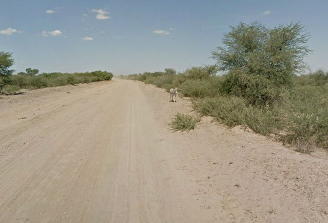
Google Street View Captures Donkey Accident

When Google Maps was capturing images of a Street View in Botswana, it appeared that this donkey had been hit by a car. However, a representative from Google Maps has confirmed that the donkey was merely enjoying a roll in the dirt and is alive and well.
Details
20 Jan 2013 12:29:00
Jensen a two-year-old False Map turtle, from the Mississippi River, gets used to his new home at Blackpool Sea Life Centre

Jensen a two-year-old False Map turtle, from the Mississippi River, gets used to his new home at Blackpool Sea Life Centre on February 13, 2012 in Blackpool, England. (Photo by Christopher Furlong/Getty Images)
Details
13 Feb 2012 12:36:00
From Britain to China to Mali, new maps showing travel times to the nearest urban centre reveal huge differences between countries. Using Open Street Map and Google, a University of Oxford team have created a visual breakdown that suggests major inequalities when it comes to commuting. Here: China. The dataset used for China was unique as it relied solely on Open Street Map, due to restrictions on accessing Google data. The population is densely concentrated in the east and accessibility is increased, whereas rural provinces in the west remain remote. (Photo by Daniel Weiss/Jennifer Rozier/Malaria Atlas Project/University of Oxford )

From Britain to China to Mali, new maps showing travel times to the nearest urban centre reveal huge differences between countries. Using Open Street Map and Google, a University of Oxford team have created a visual breakdown that suggests major inequalities when it comes to commuting. Here: China. The dataset used for China was unique as it relied solely on Open Street Map, due to restrictions on accessing Google data. The population is densely concentrated in the east and accessibility is increased, whereas rural provinces in the west remain remote. (Photo by Daniel Weiss/Jennifer Rozier/Malaria Atlas Project/University of Oxford)
Details
12 Jan 2018 06:43:00