Superstar Taylor Swift revealed the album cover and artwork for her highly anticipated 12th studio album, “The Life of a Showgirl”, on Wednesday, August 13, 2025. (Photo by Mert Alas & Marcus Piggott)
The "Wedding Palace" (Bagt Kosgi) is located in the southwest of Ashgabat. while the building was designed in a sphere shape surrounded by the eight-corner "Oguzkhan Star" on the corners of the building. There is a map of Turkmenistan on the outer space of the sphere whose radius is 32 meters and it can be seen from far away as the sun reflects off it.
On the western side of Mount Hood lies the longest glacier cave system in the contiguous United States. In 2012, these caves were mapped to a combined length of 7,166.8 feet by cave explorers Brent McGregor and Eddy Cartaya. Currently, the total passage length is hundreds of feet less. Glaciers are frozen rivers; they are always moving and changing... (Photo and caption by Josh Hydeman)
Dharma the Sumatran tiger yawns as members of the public return to Edinburgh Zoo as it opens for the first time following the easing of Scottish Governments lockdown restrictions on June 29, 2020 in Edinburgh, Scotland. Outdoor visitor attractions in Scotland have reopened along with many non-essential retailers after more than three months in lockdown, as Scotland moves into phase 2 of its “route map” for easing coronavirus restrictions. (Photo by Jeff J. Mitchell/Getty Images)
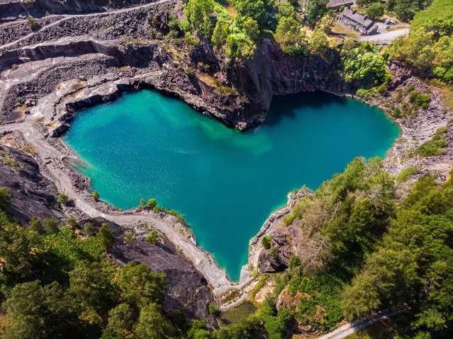
The Elterwater quarry in Cumbria, North West England on June 12, 2023 which has now reached a water level that reveals a hidden heart shape in the stone. (Photo by Steven Lomas/Animal News Agency)
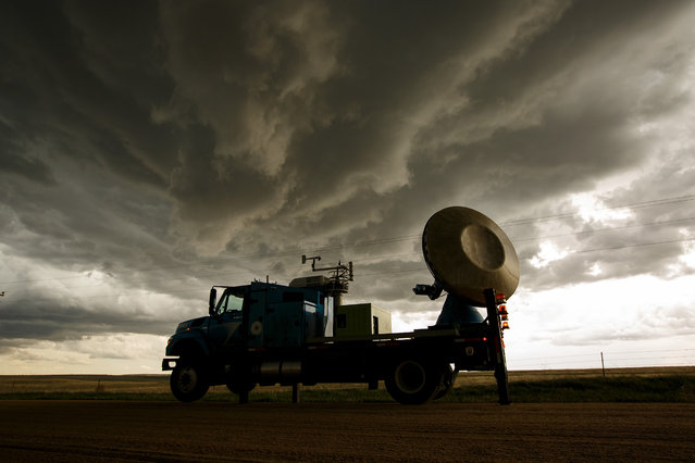
The Doppler on Wheels (DOW) vehicle scans a supercell thunderstorm during a tornado research mission, May 8, 2017 in Elbert County near Agate, Colorado. Doppler on Wheels (DOW) is a mobile doppler radar mounted on a truck that brings instruments directly into storms, allowing scientists to scan storms and tornadoes and make 3-D maps of wind and debris. (Photo by Drew Angerer/Getty Images)
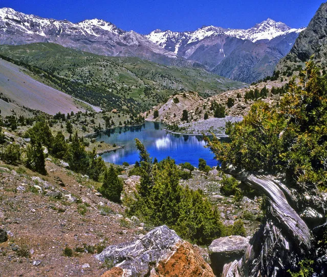
Fann Mountains are part of the western Pamir-Alay mountain system and are located in Tajikistan's Sughd Province between the Zarafshan Range to the north and the Gissar Range to the south (see map of Fann Mountains). In the east-west direction they extend from Fandarya River to Archimaydan River, and the cluster of Marguzor lakes west of Archimaydan is also included in the Fanns.
Invented in 1920′s this could be world’s first navigation system. No satellites or digital screens were used in the making of this portable navigation system. Called Plus Fours Routefinder, this little invention was designed to be worn on your wrist, and the “maps” were printed on little wooden rollers which you would turn manually as you drove along.