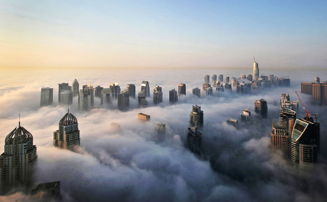
In this Monday, October 5, 2015 photo, a thick blanket of early morning fog partially shrouds the skyscrapers of the Marina and Jumeirah Lake Towers districts of Dubai, United Arab Emirates. Dubai's rapid transformation from a desert outpost into one of the world's most architecturally stunning cities is mapped out in the Marina. Where just 15 years ago there was empty, flat land, today a bustling neighborhood thrives centered around a canal and an impressive skyline that pierces through the clouds. (Photo by Kamran Jebreili/AP Photo)
10 Dec 2015 08:03:00,post received
0 comments