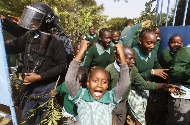
Students from Langata primary school run past riot police as they protest against a perimeter wall illegally erected by a private developer around their school playground in Kenya's capital Nairobi January 19, 2015. Riot police used teargas to disperse students at a school in Nairobi as the children protested against the potential loss of their playground. The playground was fenced off in December, during the school holidays, by a prominent developer who also claims ownership of the land. The title to the contested site is said to be in the name of Airport View Housing Limited, according to local media, with plans to use the space to build a parking lot for a hotel. (Photo by Thomas Mukoya/Reuters)
20 Jan 2015 13:04:00,post received
0 comments