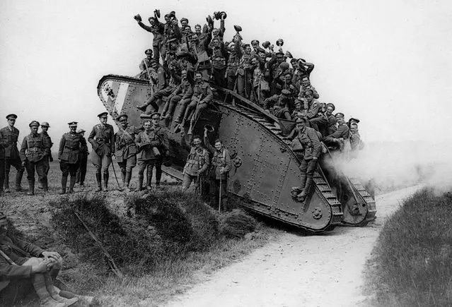
These black-and-white photos are taken from the new book “Armoured Warfare in the First World War 1916 – 1918” by Anthony Tucker-Jones and published by Pen & Sword Military. Here: British troops hitch a ride on a Mark IV after the massed tank fleet spearheading attack at Cambrai on November 20, 1917. (Photo by Anthony Tucker-Jones/Mediadrumworld.com)
23 Feb 2017 00:02:00,post received
0 comments