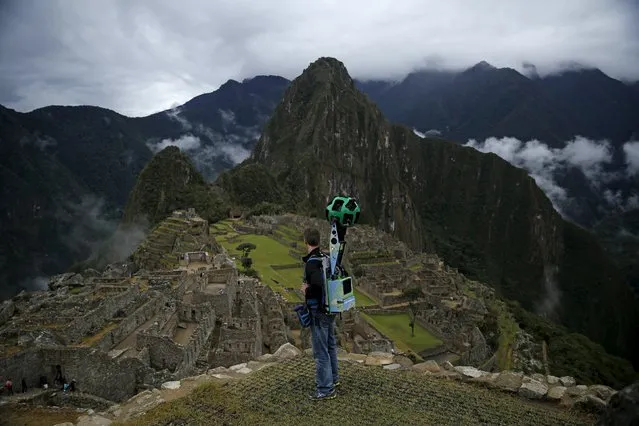
Daniel Filip, Tech Lead Manager for Google Maps, carries the Trekker, a 15-camera device, while mapping the Inca citadel of Machu Picchu for Google Street View in Cuzco, Peru, August 11, 2015. (Photo by Pilar Olivares/Reuters)
07 Dec 2015 08:02:00,post received
0 comments