29 Dec 2013 08:23:00,post received
0 comments
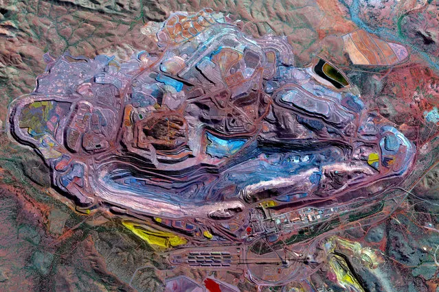
Mount Whaleback iron ore mine 23°21’32.3”S, 119°40’40.1”E. The Mount Whaleback Iron Ore Mine in the Pilbara region of Western Australia. Roughly 98% of the world’s mined iron ore is used to make steel and is thus a significant component in the construction of buildings, automobiles, and appliances such as refrigerators. (Photo by Daily Overview/DigitalGlobe, a Maxar Company)
16 Nov 2018 00:03:00,post received
0 comments
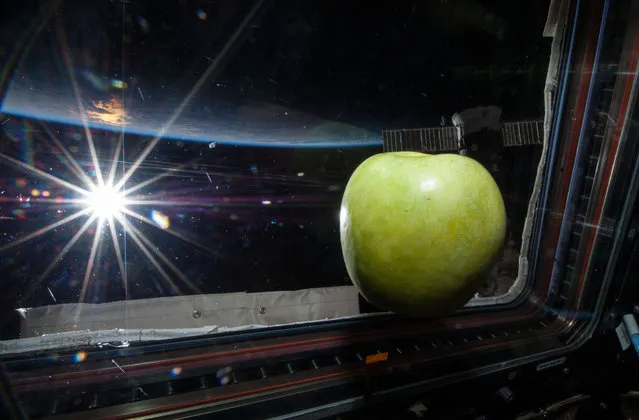
Despite any political differences between the United States and Russia, the space agencies of the two countries continue their cooperative work in Earth's orbit, aboard the International Space Station. Apart from the research being done in microgravity, ISS crew members continue to send back amazing images of our home world, photographed from low Earth orbit. Gathered here are recent images of Earth from aboard the ISS, and from a handful of other NASA satellites.
01 Jun 2014 12:36:00,post received
0 comments
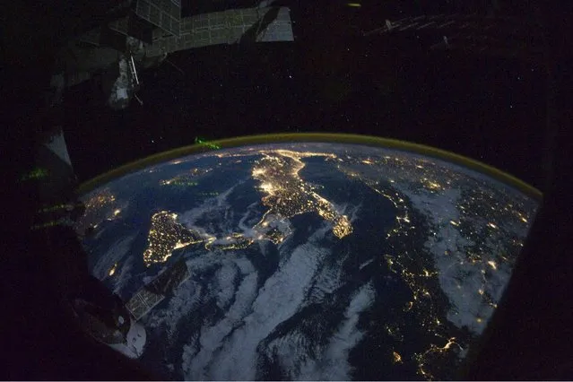
This image provided by NASA shows parts of Europe and Africa very easily recognizable in this night time image shot by one of the Expedition 25 crew members aboard the International Space Station flying 220 miles above Earth on Thursday October 28, 2010. The view “looks” northward over Sicily and the “boot” of Italy, with the Mediterranean Sea representing most of the visible water in the view and the Adriatic Sea to the right of center. Tunisia is partially visible at left. Part of a docked Russian spacecraft and other components of the ISS are in the foreground. (Photo by AP Photo/NASA)
11 May 2013 12:29:00,post received
0 comments
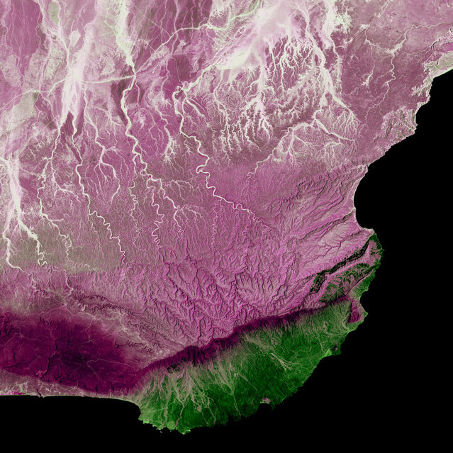
Dhofar Region, Oman. Much of Oman is desert, but the Arabian Sea coast in the Dhofar region represents a startling difference in climate. This coastal region catches the monsoon rains, or khareef, during the summer months. Drenching rains fall primarily on the mountainous ridge that separates the lush, fertile areas along the coast from the arid interior, recharging streams, waterfalls and springs that provide plentiful water supplies in the fertile lowlands for the remainder of the year. Image taken by Landsat 5 on April 2, 2005. (Photo by USGS/NASA)
25 Dec 2012 11:13:00,post received
0 comments
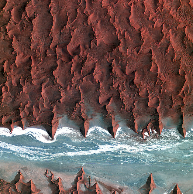
These are the dunes of the Namib Desert, taken by Korea's Kompstat-2 satellite. The blue and white area is the dried riverbed of the Tsauchab river. (Photo by The European Space Agency)
17 Aug 2014 09:13:00,post received
0 comments
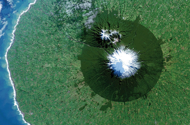
Egmont National Park in New Zealand with Mt. Taranaki at its center is seen in a Landsat 8 satellite image taken July 3, 2014 and released by NASA November 14, 2014. The image is from the book “Sanctuary: Exploring the World's Protected Areas from Space”, published by the Institute for Global Environmental Strategies with support from NASA, which was released this week. (Photo by Reuters/NASA/USGS)
16 Nov 2014 12:15:00,post received
0 comments
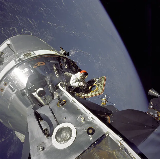
Apollo 9 Command/Service Modules (CSM) nicknamed “Gumdrop” and Lunar Module (LM), nicknamed “Spider” are shown docked together as Command Module pilot David R. Scott stands in the open hatch. Astronaut Russell L. Schweickart, Lunar Module pilot, took this photograph of Scott during his EVA as he stood on the porch outside the Lunar Module. Apollo 9 was an Earth orbital mission designed to test docking procedures between the CSM and LM as well as test fly the Lunar Module in the relative safe confines of Earth orbit. (Photo by NASA)
20 Jul 2014 11:47:00,post received
0 comments

