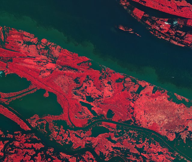
This is the Amazon River in the heart of northern Brazil's rainforest. Vegetation has been coloured with shades of pink – the darker the colour, the denser the vegetation. (Photo by The European Space Agency)
This is the Okavango River Delta in Botswana. The purple mass in the center is Chief's Island. (Photo by The European Space Agency)
Clouds sweep across the North Sea in this image from Envistat. Denmark is on the lower right corner and Norway is in the upper center. (Photo by The European Space Agency)
This photo of Northern China shows the Yellow River flowing into the Yellow Sea. Beijing and Tanjing are shaded circles in the top-center part of the photo. (Photo by The European Space Agency)
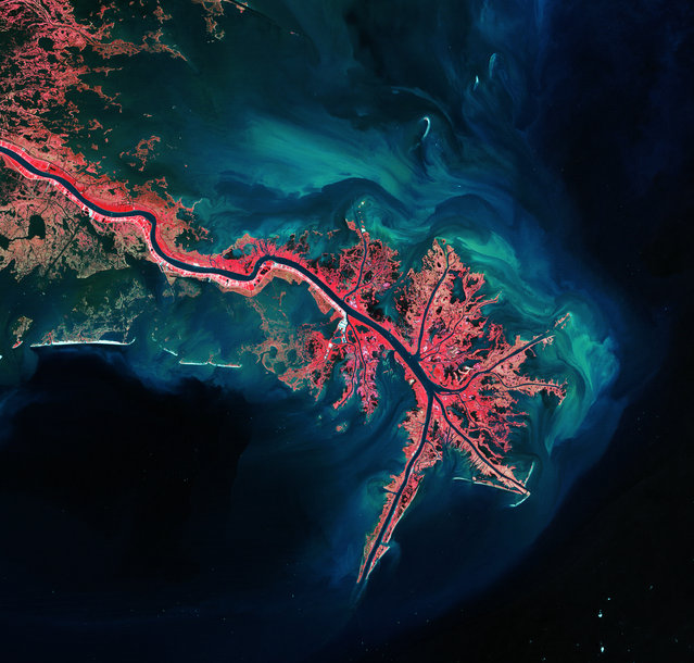
This is the Mississippi River Delta, where it empties into the Gulf of Mexico. Vegetation is coloured pink and sediment is bright blue and green. (Photo by The European Space Agency)
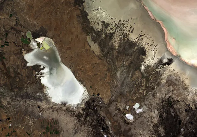
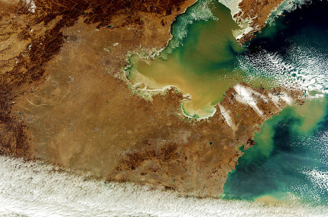
This is a central plateau in Anatolia, Turkey. Turkey's second-largest lake, Lake Tuz, is on the right. During the summer, the lake water recedes to reveal a thick layer of salt. (Photo by The European Space Agency)
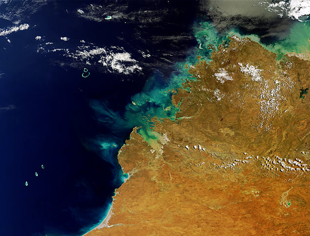
This is Western Australia's Kimberley Region. On the lower left are the Rowley Shoals coral reefs and on the upper-right is Lake Argyle, Australia's largest artificial lake. (Photo by The European Space Agency)
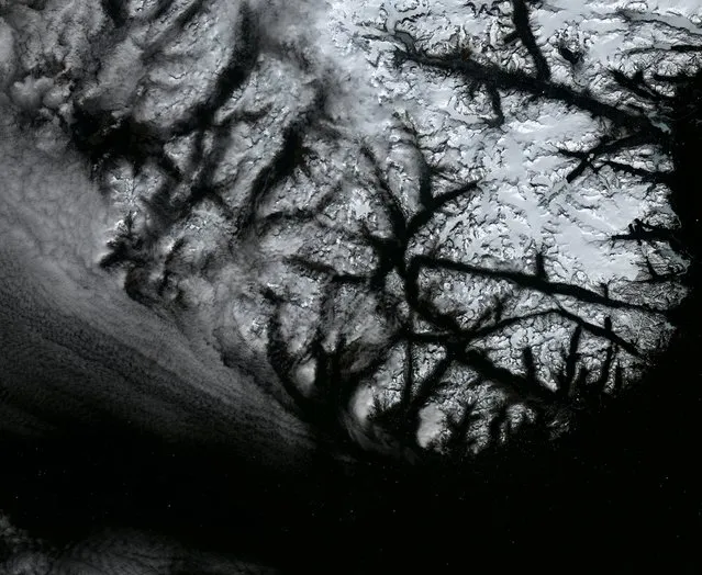
This image of the Arctic Circle was taken by Envistat a month before the ESA lost contact. The Novaya Zemlya archipelago is on the left and mainland Russia is on the right. (Photo by The European Space Agency)
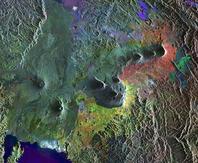
These are the Virunga Mountains in Rwanda, a dangerous chain of active volcanoes. (Photo by The European Space Agency)
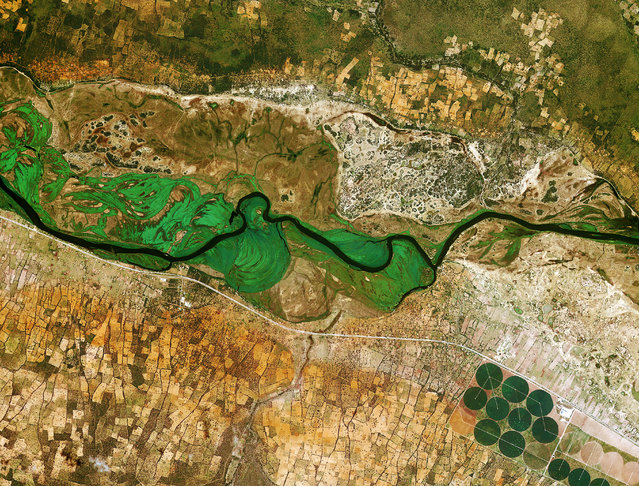
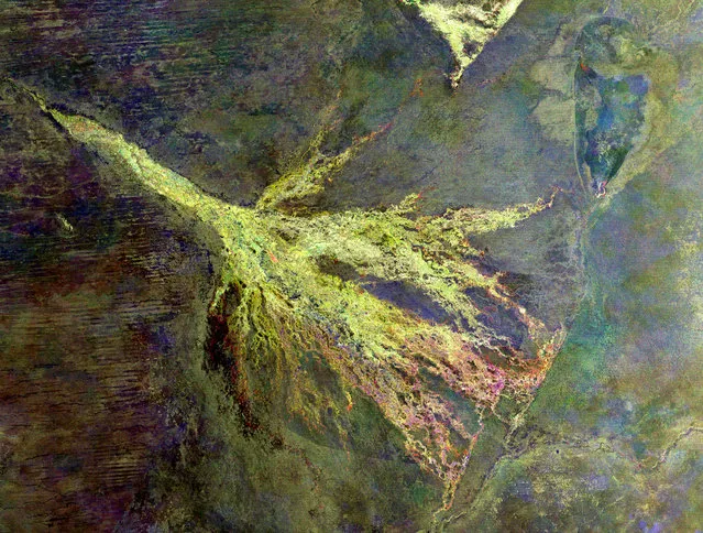
The Okavango River runs from Angola to Botswana. Here it marks the border between Namibia and Angola. (Photo by The European Space Agency)
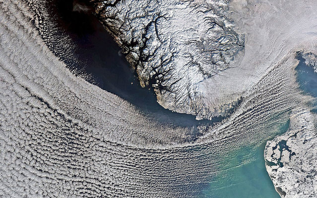
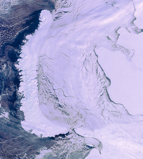
These are the ice sheets of Greenland, the largest island in the world. The white dots at the bottom of the image are icebergs. (Photo by The European Space Agency)
This is the rolling farmland of southeastern Washington state. The swirling patterns are created by plows. (Photo by The European Space Agency)
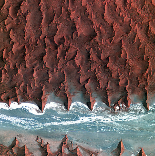
These are the dunes of the Namib Desert, taken by Korea's Kompstat-2 satellite. The blue and white area is the dried riverbed of the Tsauchab river. (Photo by The European Space Agency)
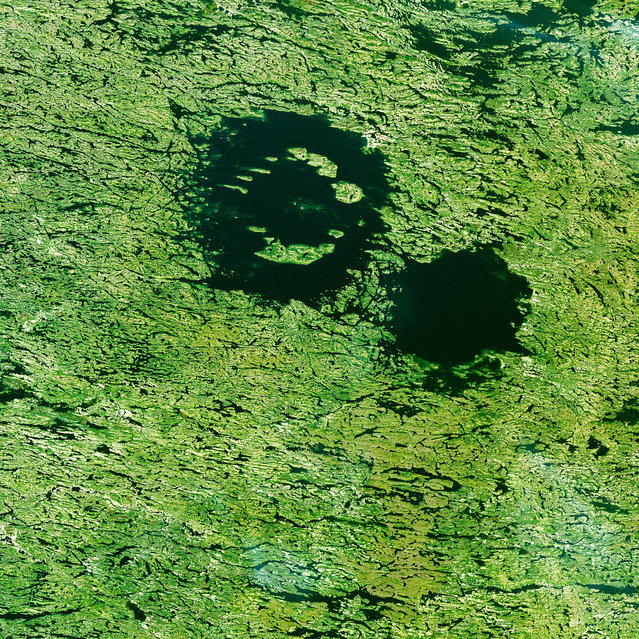
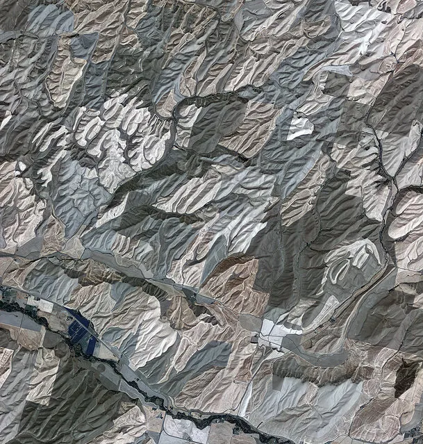
The Clearwater Lakes in Quebec are not actually two separate lakes, but a single body of water over two depressions, created by meteorite impacts over 200 million years ago. (Photo by The European Space Agency)
17 Aug 2014 09:13:00,
post received
0 comments