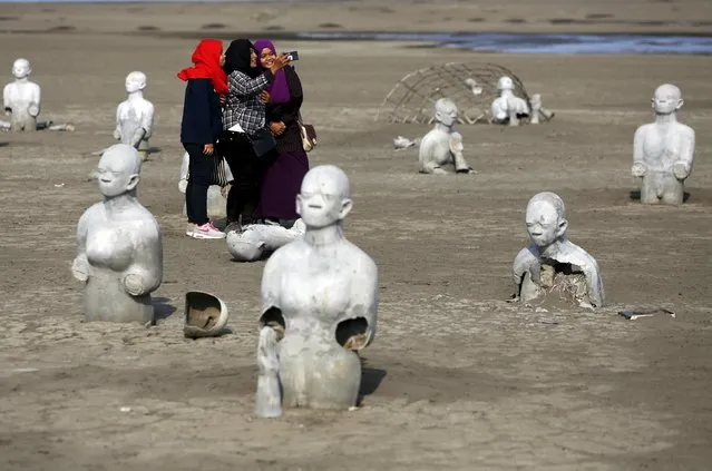
Women take pictures between stone sculptures of half-buried people at the Lapindo mud field in Sidoarjo, October 11, 2015. Disaster tourism has become more common in Indonesia, where visitors are drawn to sites of earthquakes, floods and volcanic eruptions to witness the aftermath of catastrophes or simply do some soul-searching. (Photo by Reuters/Beawiharta)
30 Oct 2015 08:01:00,post received
0 comments