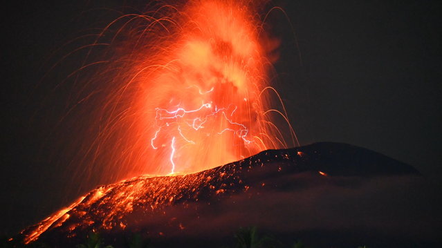
A handout photo made available by Indonesia's Center for Volcanology and Geological Hazard Mitigation shows hot lava spewing from Mount Ibu in North Maluku province, Indonesia, 04 July 2024 (issued 05 July 2024). The Center for Volcanology and Geological Disaster Mitigation (PVMBG) advises the community around Mount Ibu and visitors not to carry out activities within a radius of 2.0 kilometers and a sectoral expansion of 5 kilometers towards the crater opening in the northern part of the active crater of Mount Ibu. (Photo by PVMBG/EPA)
09 Jul 2024 05:14:00,post received
0 comments