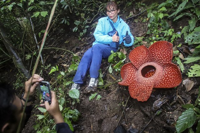
A woman poses for a photo with the Rafflesia Arnoldii flower at Palupuah Forest, Agam District, West Sumatra, Indonesia on September 16, 2024. Palupuh forest is located at an altitude of 975 meters above sea level, with temperatures reaching 18-20 degrees Celsius. According to The West Sumatera Nature Conservation Agency (BKSDA), in the province of West Sumatra there are 36 points where this endangered flower grows. (Photo by Adi Prima/Anadolu via Getty Images)
07 Oct 2024 02:44:00,post received
0 comments