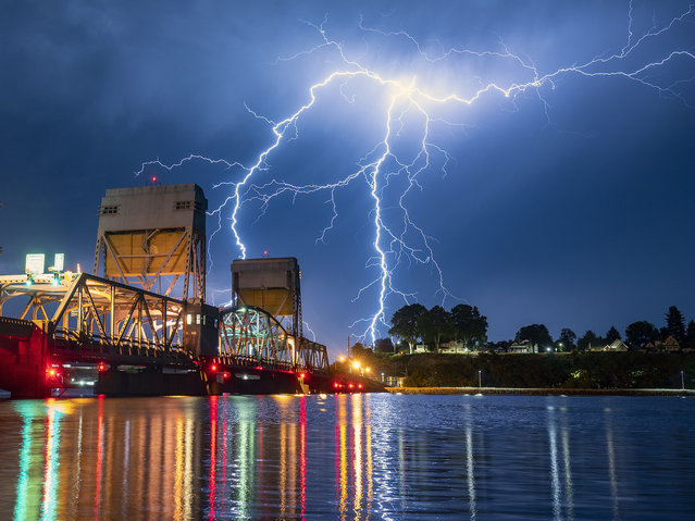
A bolt of lighting strikes over Lewiston, Idaho, behind the Interstate Bridge that spans the Snake River into Clarkston, Wash., on the morning of Thursday, July 1, 2021. Multiple thunderstorms moved through the area on Wednesday evening into Thursday morning. (Photo by Pete Caster/Lewiston Tribune via AP Photo)
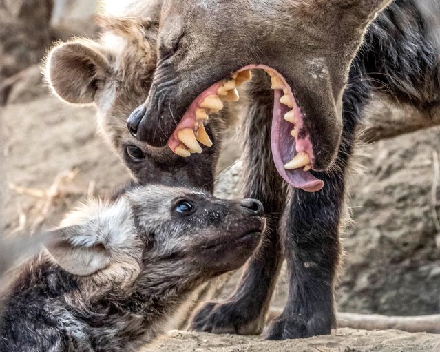
A hyena cub got a mouthful from his mum after it appears he got a right telling off. Michael Raddall, a animal enthusiast and wildlife photographer from South Africa, snapped the mum and cub at the Timbavati game reserve in South Africa while on safari at the Umlani Bush camp. (Photo by Michael Raddall/Caters News Agency)
From Britain to China to Mali, new maps showing travel times to the nearest urban centre reveal huge differences between countries. Using Open Street Map and Google, a University of Oxford team have created a visual breakdown that suggests major inequalities when it comes to commuting. Here: China. The dataset used for China was unique as it relied solely on Open Street Map, due to restrictions on accessing Google data. The population is densely concentrated in the east and accessibility is increased, whereas rural provinces in the west remain remote. (Photo by Daniel Weiss/Jennifer Rozier/Malaria Atlas Project/University of Oxford)
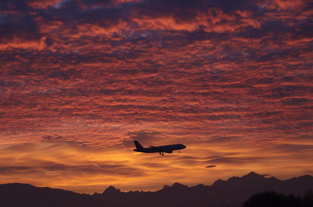
A Brussels Airlines aircraft prepares for landing in Cointrin airport during sunrise over the Mont Blanc in Geneva December 1, 2011. (Photo by Denis Balibouse/Reuters)
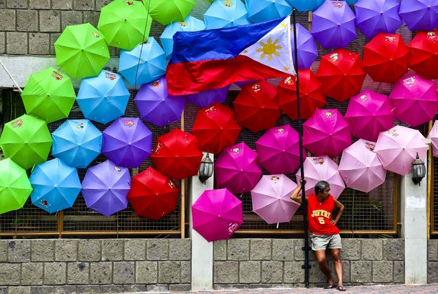
A man stands beside the Philippine flag as colorful umbrellas adorn a village hall in suburban San Juan, east of Manila, Philippines, on June 27, 2013. (Photo by Aaron Favila/Associated Press)
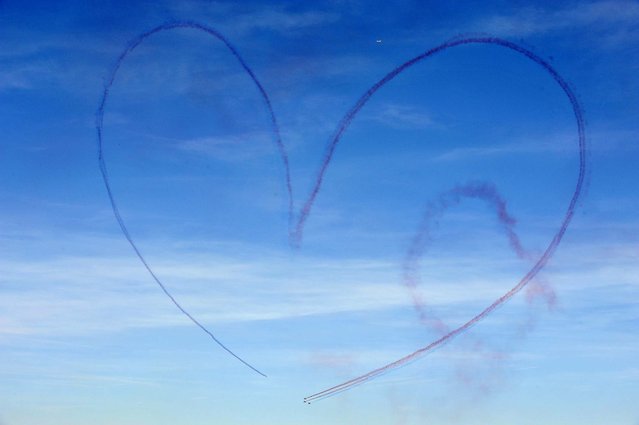
Alphajet aircraft draw a heart-shaped message in the sky during the 2010 presentation show of the French aerobatics team Patrouille de France, over the French city of Salon-de-Provence. (Photo by Gerard Julien/AFP Photo)