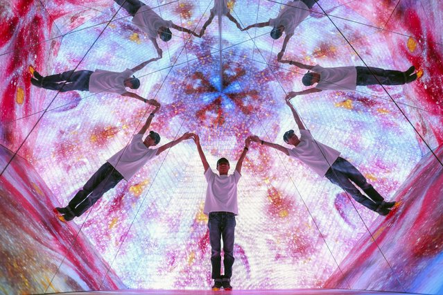
A man reacts inside the projection mapping and interactive installation known as “Illusion Road” at the multi-dimensional media art gallery Immersify KL in Kuala Lumpur, Malaysia, 04 March 2025. Immersify KL attracts visitors with interactive installations, high-definition visuals, and 3D spatial sound, creating breathtaking zones, including the country's first 360-degree, 12-meter-high projection space inside a 30,000-square-foot area with 11 sections of different immersive zones. (Photo by Fazry Ismail/EPA)