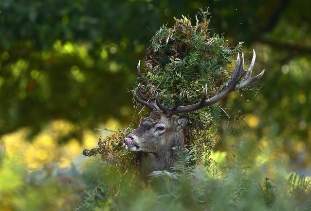
A male red deer with antlers covered in bracken, walks through undergrowth in Richmond Park in south west London, October 3, 2014. Over 600 red and fallow deer roam in the largest of London's Royal Parks, and have their numbers managed in an annual cull each November and February. (Photo by Toby Melville/Reuters)
Actress Riley Keough reacts to the cameras at the Baby2Baby 10-Year Gala in Los Angeles, California on November 13, 2021. (Photo by Action Press/Rex Features/Shutterstock)
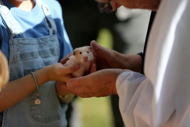
Reverend Peter Wall blesses a hamster during “The Blessing of Animals” at St. James Cathedral in Toronto, Ontario, Canada on September 30, 2023. (Photo by Mert Alper Dervis/Anadolu Agency via Getty Images)
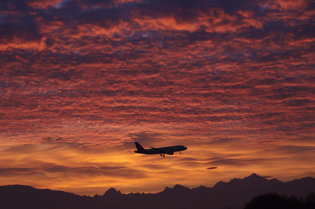
A Brussels Airlines aircraft prepares for landing in Cointrin airport during sunrise over the Mont Blanc in Geneva December 1, 2011. (Photo by Denis Balibouse/Reuters)
From Britain to China to Mali, new maps showing travel times to the nearest urban centre reveal huge differences between countries. Using Open Street Map and Google, a University of Oxford team have created a visual breakdown that suggests major inequalities when it comes to commuting. Here: China. The dataset used for China was unique as it relied solely on Open Street Map, due to restrictions on accessing Google data. The population is densely concentrated in the east and accessibility is increased, whereas rural provinces in the west remain remote. (Photo by Daniel Weiss/Jennifer Rozier/Malaria Atlas Project/University of Oxford)
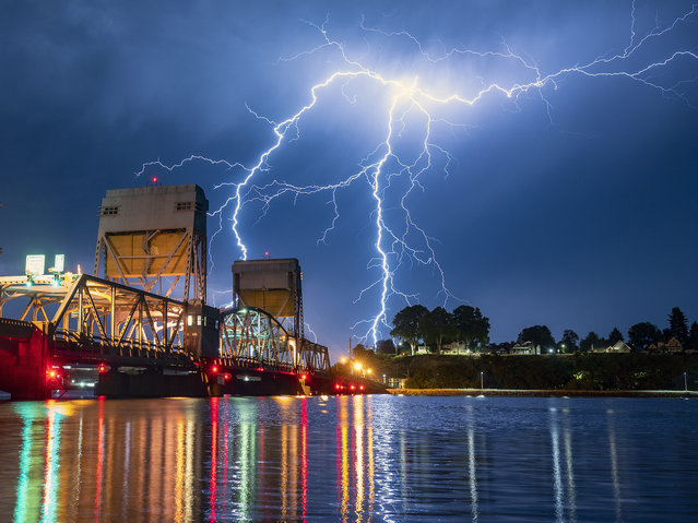
A bolt of lighting strikes over Lewiston, Idaho, behind the Interstate Bridge that spans the Snake River into Clarkston, Wash., on the morning of Thursday, July 1, 2021. Multiple thunderstorms moved through the area on Wednesday evening into Thursday morning. (Photo by Pete Caster/Lewiston Tribune via AP Photo)