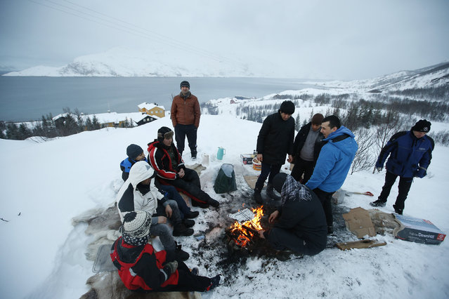
In this photo taken Tuesday, February 2, 2016, asylum seekers gather round a fire as they cook a meal overlooking the temporary Altnes camp refugee camp on the island of Seiland, northern Norway. Waiting for their asylum claims to be processed, hundreds of people in emergency shelters in Hammerfest and neighboring towns are slowly getting used to the extreme climate and unfamiliar customs of the High North. They say they have adapted to the cold – the temperature rarely drops below minus 10 degrees C (14 F) along the coast, though it gets much colder further inland. It’s the darkness that throws them off. (Photo by Alastair Grant/AP Photo)
18 Feb 2016 13:22:00,post received
0 comments