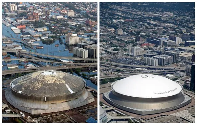
This combination of August 30, 2005 and July 29, 2015 aerial photos shows downtown New Orleans and the Superdome flooded by Hurricane Katrina and the same area a decade later. Katrina's powerful winds and driving rain bore down on Louisiana on August 29, 2005. The storm caused major damage to the Gulf Coast from Texas to central Florida while powering a storm surge that breached the system of levees that were built to protect New Orleans from flooding. (Photo by David J. Phillip/Gerald Herbert/AP Photo)
29 Aug 2015 11:22:00,post received
0 comments