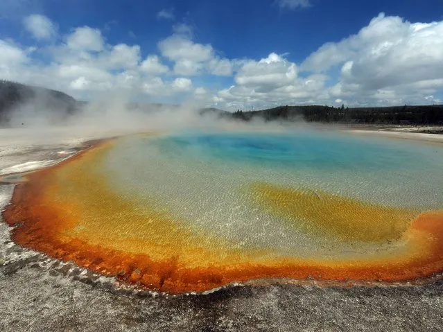
View of the “Sunset Lake” hot spring with it's unique colors caused by brown, orange and yellow algae-like bacteria called Thermophiles, that thrive in the cooling water turning the vivid aqua-blues to a murkier greenish brown, in the Yellowstone National Park, Wyoming on June 1, 2011. Yellowstone National Park, was established by the U.S. Congress and signed into law by President Grant on March 1, 1872. The park is located primarily in the U.S. state of Wyoming, though it also extends into Montana and Idaho and was the first national park in the world. It is known for its wildlife and its many geothermal features, especially the Old Faithful Geyser. (Photo by Mark Ralston/AFP Photo)
06 Apr 2014 08:02:00,post received
0 comments