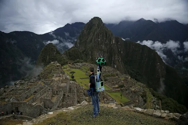
Daniel Filip, Tech Lead Manager for Google Maps, carries the Trekker, a 15-camera device, while mapping the Inca citadel of Machu Picchu for Google Street View in Cuzco, Peru, August 11, 2015. (Photo by Pilar Olivares/Reuters)
Defined according to wikipedia it is “a recent and informal geologic chronological term that serves to mark the evidence and extent of human activities that have had a significant global impact on the Earth’s ecosystems. The term was coined by ecologist Eugene Stoermer but has been widely popularized by the Nobel Prize-winning atmospheric chemist Paul Crutzen.”
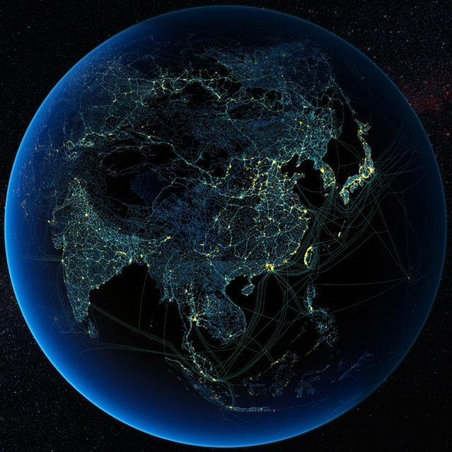
The images here where created by Felix Pharand-Deschenes depicting how various human influences, from road and rail, to internet cables and airlines create significant patterns covering the Earth. What can we learn from these patterns in how they are influencing the environment
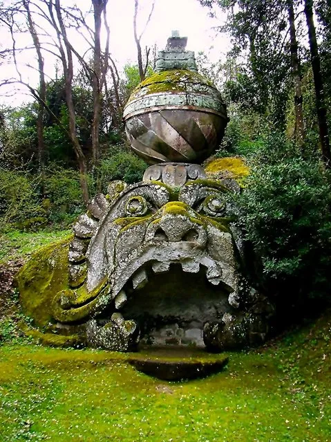
Bomarzo's main attraction is a garden, usually referred to as the Bosco Sacro (Sacred grove) or, locally, Bosco dei Mostri ("Monsters' Grove"), named after the many larger-than-life sculptures, some sculpted in the bedrock, which populate this predominantly barren landscape.
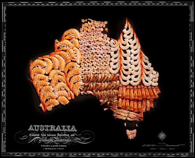
Photographer Henry Hargreaves and artist Caitlin Levin have been working together for about decade. Their shared love for “food, photography, travel, and art” has found an outlet in a series of maps that they have illustrated with food.
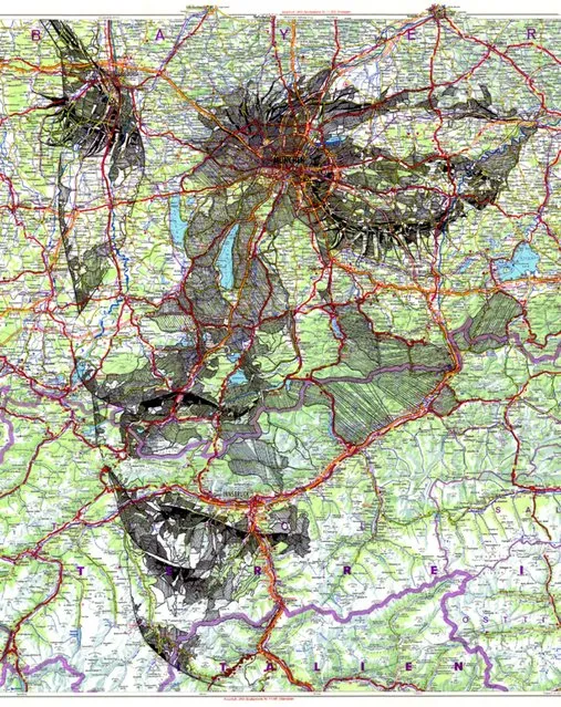
A talented artist has created breathtaking intimate portraits by using detailed maps of the world as his canvas. Cardiff-based illustrator, Ed Fairburn, combines the patchwork of roads, terrains and rivers to for his unique sketches. Photo: Ink on a 1977 road map of Germany. (Photo by Ed Fairburn/Rex Features)
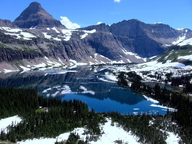
Glacier National Park is a national park located in the U.S. state of Montana, on the Canada–United States border with the Canadian provinces of Alberta and British Columbia. The park encompasses over 1,000,000 acres (4,000 km2) and includes parts of two mountain ranges (sub-ranges of the Rocky Mountains), over 130 named lakes, more than 1,000 different species of plants and hundreds of species of animals. This vast pristine ecosystem is the centerpiece of what has been referred to as the "Crown of the Continent Ecosystem", a region of protected land encompassing 16,000 square miles (41,000 km2).