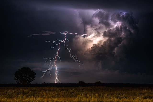
An incredible clear-air lightning display from storms to the east of Noonamah, just outside Darwin on April 6, 2015. (Photo by Jacci Ingham/The Guardian)
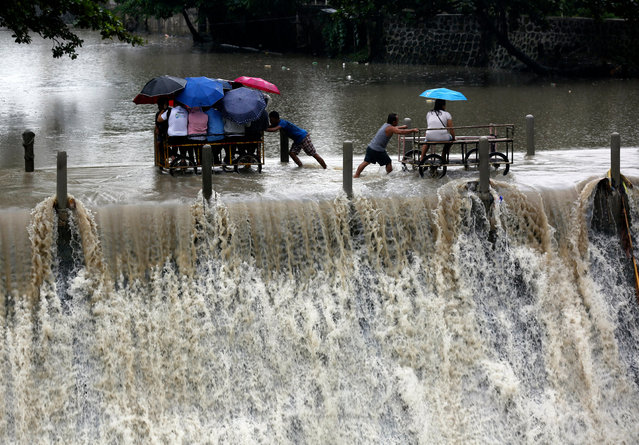
Filipinos riding on makeshift carts cross over an overflowing dam during a downpour in Las Pinas city, south of Manila, Philippines, 05 September 2017. According to the latest forecast from the Philippine Atmospheric Geophysical and Astronomical Services Administration (PAGASA) state weather bureau, typhoon signals were raised over Northern Luzon brought by a tropical storm (local name: Tropical Storm Kiko) and warned fisherfolks and small seacrafts not to venture onto the sea due to big waves. (Photo by Francis R. Malasig/EPA/EFE)
Clash of the storms, New Mexico, US by Camelia Czuchnicki. “A clash between two storm cells in New Mexico, US, each with its own rotating updraft. The curved striations of the oldest noticeable against the new bubbling convection of the newer. It was a fantastic sight to watch and it’s the rarity of such scenes that keep drawing me back to the US Plains each year”. (Photo by Camelia Czuchnicki/Weather Photographer of the Year 2016)
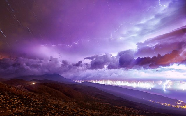
A handout photo made available by TeideLab shows an image composed of 200 pictures that shows the lightning activity between 3 am and 7am during a storm in Izana, Tenerife, Canary Islands, Spain, 27 October 2019. Over 2,000 lighting strikes fell mostly over Tenerife island last 26 October during a strong storm. (Photo by Daniel López/EPA/EFE/TeideLab)
Filipino children frolic next to ships taking shelter inside a seaport in Navotas city, north of Manila, Philippines, 27 August 2019. According to the latest advisory from Philippine Atmospheric Geophysical and Astronomical Services Administration (PAGASA), Tropical Storm Podul intensified from a tropical depression into a tropical storm on August 27, while moving toward Central Luzon with a maximum winds of 65 kilometers per hour and gustiness of up to 80 km/h. (Photo by Francis R. Malasig/EPA/EFE)