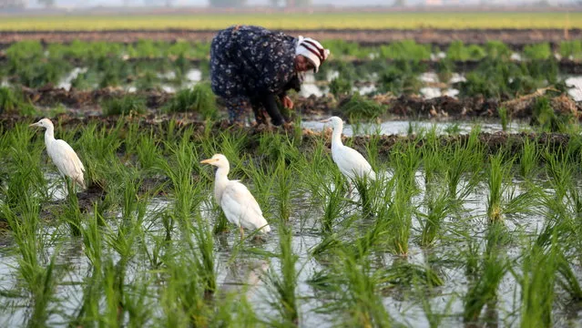
Egrets stand on a field as an Egyptian farmer plants rice seedling in Egypt's fertile Delta in Tanta, Algharbeya governorate, 100 km from Cairo, Egypt, 22 June 2022. Egyptian Government reduced the planting of some crops that need a massive amount of irrigation water, while the government said it will reduce the rice agriculture area in Egypt, amid fear the Renaissance Dam project in Ethiopia could affect the amount of River Nile water reaching Egypt. (Photo by Khaled Elfiqi/EPA/EFE)