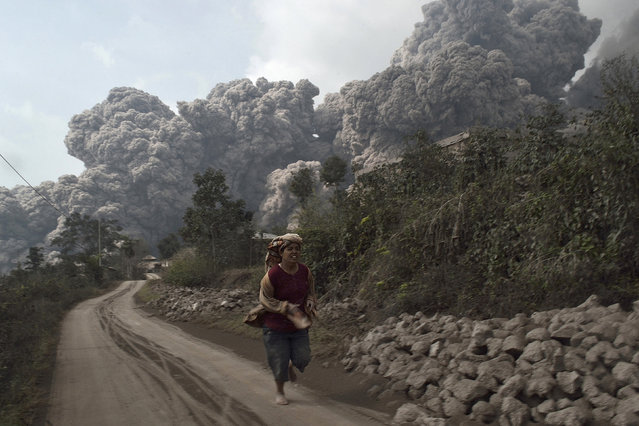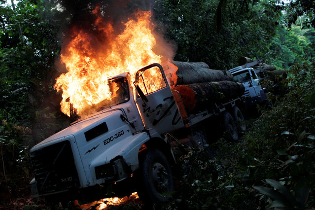
Trucks loaded with tree trunks are burned by agents of the Brazilian Institute for the Environment and Renewable Natural Resources, or Ibama, during an operation to combat illegal mining and logging, in the municipality of Novo Progresso, Para State, northern Brazil, November 11, 2016. When able to do their job, agents of the Brazilian Institute for the Environment and Renewable Natural Resources, or Ibama, are decisive, punishing illegal loggers on the spot. Nearly twice the size of India, the Amazon absorbs an estimated 2 billion tonnes of carbon dioxide per year, making its preservation vital in the fight to halt global warming. (Photo by Ueslei Marcelino/Reuters)
30 Nov 2016 12:36:00,post received
0 comments